Halesowen Weather

[ Home ] Weather Station Details ] Recent Years ] 30 Year Summaries 1971-2000 ] 30 Year Summaries 1981-2010 ] 30 Year Summaries 1991-2020 ] Trends ] 50 Years of Records ] CET Long Term Records ] Satellite Imaging ] Photo Album ] Projects ] Calculation Tools ] Requests for Information ] Glossary of Terms ] Useful Links ]


DECEMBER 2025


Mostly a mild and quite wet month, 
but finishing much colder and dry

ANNUAL 2025

Overall 2025 was the 2nd warmest year and amongst the driest
although several months were both warm and dry

Halesowen 70 year, 10 year and 30 year Overview
Basic statistics about temperature and rainfall, and more, 
have all been updated to the end of 2020...
See   50 Years of Records  and  30 Year Summaries 1991-2020


Halesowen, West Midlands

lies 13km to the west of Birmingham 
in central England. 

Find out about the weather 
here for the last 69 years


2026 Weather

2025 Weather

2024 Weather
2023 Weather
 2022 Weather
 
 2021 Weather 

 
2020 Weather 


Late Frosts?


Long term records
  70 years monthly stats
Details 1956 to present
Extremes  
Central England Records
   Articles from 1947, 1979-2003
 30 year stats 1991-2020


Calculation Tools 
to work out things like dew point and wind chill, and lists of sunrise and sunset times. 

Try my links to some other useful weather websites.

Requests for Information


DECEMBER 2025

Temperatures for December were higher than normal until 24th when they fell well below. Overall the mean temperature for the month was the 8th highest in 71 years here. Rainfall occurred most days until the 21st when it turned mainly dry. The overall monthly rainfall was 14% more than normal, the 26th highest in 71 years.  There was only one air frost, on 31st, the 3rd fewest, only two years having none. There were 9 nights having ground frost, the 14th = fewest.  No snowfall, hail or thunder but 3 days had fog. Winds were predominantly mild from the S for most of the month, but becoming colder NE/E at the end. 

---------------------------------------------------

SEASONAL REPORT FOR AUTUMN 
 
(Sep, Oct, Nov 2025)

A slightly milder, but very much wetter autumn than normal. While the temperatures fell through the 3 months as expected,  nearly half the season's rain fell in November, most days having some rainfall, and two days (11th and 14th Nov) together had a month's rainfall, September's rainfall was well over average amd October's a bit higher than usual.

The distribution of rainfall in the 4 seasons this year has been (in 70 years here):
Winter D/J/F       236.2mm,    19th HIGHEST

Spring M/A/M     67.4mm,      2nd LOWEST
Summer J/J/A  100.8mm,      8th LOWEST

Autumn S/O/N   328.4mm,     6th HIGHEST

               this year     normal    anomaly
HiMax         22.7           30.8
MeanMax  14.3           14.1              +0.2        22nd = highest   
LoMax         3.6           -2.0                              
MEAN         10.9           10.6              +0.3        13th = highest
HighMin      14.7          17.1                             
MeanMin      7.6            7.1              +0.5        12th = highest
LoMin          -3.6           -8.1                  
RAINFALL   328.4        232.0           141.6%        6th highest
Raindays        63          49.7            126.8%        6th highest
Wet Days       43           35.8            120.1%        8th highest
V Wet Days    19           15.0           126.7%      11th highest

TEMPERATURES

8.3 mean max (C) , 12th = mildest in 71 years here.
   4.1 mean min (C)  , 8th mildest
   6.2 mean (C)   +1.6 above normal, 
the 8th  mildest

 13.2 high max (C) on 9th  
   4.2 low max (C) on  31st  
   9.6 high min (C) on  9th  
  -3.2 low min (C)  on  31st 

RAINFALL

89.6 rain total (mm)  114% of av , ranking 26th highest.
Wettest days were 11.0mm on 15th  , 9.6mm on 18th  ,9.4mm on 8th

21 raindays (days with >=0.2mm), 
19th = greatest
16 wetdays (days with >=1mm),  
16th  = greatest
  7 very wet days (days with >=5mm), 20th = greatest

OTHER  

Ground frost on 9 days,  the 14th fewest.
Air frost on 1 day, the 3rd fewest
Fog on 3 days. 3rd, 20th and 21st  
69% cloud cover percent
89% mean RH 

Mean pressure was 1014.3mb
Max pressure  1038.6mb was recorded on 27th, the 20th highest
Min pressure    988.2mb was recorded  on 6th, the 27th highest.

Windiest days were 1st and 9th, then 14th and 17th  .


COMPARISON OF SPRING 2024 with SPRING 2025


    2025

Mar

Apr

May

SPRING (M,A,M)

MMax temp
30yr average
anomaly
70year ranking

13.4C 
10.6C
+2.8deg
new record hi

18.1C  
14.1C
+4.0deg
3rd highest

20.4C  
17.4C
+3.0deg
2nd highest

17.3C  
14.0C +3.3deg
new record hi

MEAN TEMP
30yr average
anomaly
70year ranking

  8.2C 
  6.8C
+1.4deg
6th highest

 11.6C 
  9.3C
+2.3deg
3rd highest

14.3C
12.4C  +1.9deg
2nd highest

11.3C
  9.5C   +1.8deg
new record

MMin temp
30yr average
anomaly
70year ranking

  3.0C 
  2.9C
+0.1deg
26th = highest

  5.1C
  4.6C
+0.5deg
14th highest

  8.2C  
  7.4C
+0.8deg
9th highest

  5.4C 
  5.0C +0.4deg
10th highest

RAINFALL mm
30yr average
anomaly
70year ranking

10.6mm
 54.4mm
19.5%
2nd lowest

29.2mm
60.0mm
48.0%
17th lowest

27.6mm
60.4mm
45.7%
10th lowest

  67.4mm
 173.5mm    38.9%
2nd lowest


2024

Mar

Apr

May

SPRING (M,A,M)

MMax temp
30yr average
anomaly
70year ranking

11.3C 
10.6C
+0.7deg
16th highest

13.9C  
14.1C
-0.2deg
21st highest

19.6C  
17.4C
+2.2deg
4th highest

15.0C  
14.0C +1.0deg
8th = highest

MEAN TEMP
30yr average
anomaly
70year ranking

  8.0C 
  6.8C
+1.2deg
8th highest

  9.7C 
  9.3C
+0.4deg
14th highest

14.7C
12.4C  +2.3deg
new record hi

10.8C
  9.5C   +1.3deg
3rd = highest

MMin temp
30yr average
anomaly
70year ranking

  4.7C 
  2.9C
+1.8deg
3rd = highest

  5.5C
  4.6C
+0.9deg
9th highest

  9.8C  
  7.4C
+2.4deg
new record hi

  6.7C 
  5.0C +1.7deg
new record hi

RAINFALL mm
30yr average
anomaly
70year ranking

103.0mm
 54.4mm
189.3%
6th highest

73.8mm
60.0mm
123.0%
16th highest

73.0mm
60.4mm
120.9%
19th highest

 249.8mm
 173.5mm    144.0%
6th highest


Halesowen Annual Summary for 2025  

MONTHLY RAIN AND MEAN TEMPS

month

JAN

FEB

MAR

APR

MAY

JUN

JUL

AUG

 SEP

OCT

NOV

DEC

rain mm

89.6

48.6

10.6

29.2

27.6

31.6

45.6

23.6

90.6

80.2

157.6

89.6

30yr rain avg

72.1

55.0

54.4

60.0

60.4

72.1

63.4

70.0

65.2

84.1

82.0

78.2

rain %

124%

88%

19%

47%

46%

44%

72%

34%

139%

95%

192%

115%

Rain rank


temp C

2.7

5.0

8.2

11.6

14.3

18.1

19.2

18.5

14.0

11.0

7.8

6.2

30yr temp avg

4.3

4.7

6.8

9.3

12.4

15.3

17.2

16.8

14.2

10.6

7.0

4.6

anomaly

-1.6

+0.3

+1.4

+2.3

+1.9

+2.8

+2.0

+1.7

-0.2

+0.4

+0.8

+1.6

70yr temp avg

3.8

4.1

6.2

8.5

11.8

14.7

16.6

16.2

13.8

10.5

6.6

4.5

TEMPERATURES

15.8 mean max (C) ,   +1.6 diff from av (C)                         
  7.0 mean min (C) ,    +0.7 diff from av (C)                          
 11.4 mean (C),           +1.1  diff from av (C) 

HiMax 35.9 C on  11/7/25      LoMax   0.6C  on  8/1/25
HiMin   18.4C on 13/8/25       LoMin   -5.6C on  9/1/25
Highest Mean  25.0C on 11/7/25 (the 18th highest on record here)
Lowest Mean   -2.0C was on 10/1/25

Mean of means  11.4C, 2nd = highest, beaten only in 2006 with 11.6C
 

RAINFALL

 724.4 rain total (mm), 89% of av                    ranks 22nd lowest in 71 years

 192 raindays (with 0.2mm or more)               ranks 27th highest
 113 wetdays (with 1mm or more)                   ranks 8th = lowest
   45 verywetdays (with 5mm or more)              ranks 15th = lowest

39.2mm most rainfall in a day on 14/11/25, 25th = highest
Rainfall duration 612.5  hours

SNOWFALL

1day with snow falling, totalling 2.5 cm.  Most snowfall in a day 2.5cm on 4/1/25
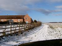
3 days with lying snow on   4/1/25, 5/1/25 and 6/1/25


PRESSURE

 1015.6 mean pressure (mb) ,  +0.7mb pressure anomaly (mb), normal is 1014.9 mb
 1045.7 max pressure at any time of day, on 6/2/25, ranks 10th highest 
   972.5 min pressure at any time of day, on 6/1/25

FOG

18 days with fog .    3 in Jan, 2 in Feb, 1 in April, 5 in Oct, 4 in Nov, 3 in Dec

FROSTS   
39 air frosts,  the last was 19/3/25 , first was 18/11/25
140 ground frosts, the last was 9/5/25 , first was 22/9/25
so 136 days with no air or ground frost.  Frost duration  292 hours.

THUNDER     7 days with thunder heard
HAIL                 No days with hail
HUMIDITY            84% at 0900
CLOUD COVER    58% at 0900  , 5th lowest (although subjective!)

 
Overall 2025 was the 2nd warmest year here in the last 71 years, beaten only in 2006.  All months in 2025 had a positive anomaly, especially April through to August, only January and September has a negative anomaly.

The highest 20 annual mean temperatures here have all occurred since 2002, except for 1990.

 Overall 2025 ranked 22nd driest in 71 years records. Four months had more rainfall than normal, Jan, Sep, Nov and Dec, the other months had less rainfall,  especially March through to June  and August, when less than half the normal rainfall occurred.

The highest 12 annual rainfall totals have all occurred since 2000, except for 1960.
Of the years with the highest number of rain days 3 have been since 2020.

The 22 years with least air frost days have all been since 2002. 
Unsurprisingly the 19 years with least snow days have all been since 2000, except for 1957, 1961 and 1992.


Halesowen Annual Summary for 2024

2024 was a very mild and wet year.

The year enjoyed the 6th highest annual mean temperature of 11.0C in 70 years records here.
Four months Feb, Mar, May and Dec had mean anomalies over 1 degree, while the lowest anomaly in Sept was only –0.4 degrees..
Annual rainfall ranked 11th highest, 935.2mm. The 237 raindays (with 0.2mm or more) was highest on record, and equals the 2023 record. Wet days ranked 9th = highest and Very Wet days ranked 12th highest.
A new record of fog days was set.


MONTHLY RAIN AND MEAN TEMPS

month

JAN

FEB

MAR

APR

MAY

JUN

JUL

AUG

 SEP

OCT

NOV

DEC

rain mm

55.6

125.4

103.0

73.8

73.0

36.2

57.0

33.0

122.4

69.6

88.2

98.0

30yr rain avg

72.1

55.0

54.4

60.0

60.4

72.1

63.4

70.0

65.2

84.1

82.0

78.2

rain %

77%

228%

189%

123%

121%

50%

90%

47%

188%

83%

108%

125%

Rain rank


highest

3rd highest


2nd lowest


lowest

2nd highest 


temp C

4.3

7.4

8.0

9.7

14.7

15.1

17.1

17.4

13.8

11.0

6.7

6.4

30yr temp avg

4.3

4.7

6.8

9.3

12.4

15.3

17.2

16.8

14.2

10.6

7.0

4.6

anomaly

0.0

+2.7

+1.2

+0.4

+2.3

-0.2

-0.1

+0.6

-0.4

+0.4

-0.3

+1.8

65yr temp avg

3.8

4.1

6.2

8.5

11.8

14.7

16.6

16.2

13.8

10.5

6.6

4.5

 TEMPERATURES

14.8 mean max (C) ,   +0.6 diff from av (C)                         
  7.2 mean min (C) ,    +0.9 diff from av (C)                          
 11.0 mean (C),           +0.7  diff from av (C)   6th highest in 70 years           

HiMax 31.7 C on  25/6/24      LoMax   1.2C  on  19/11/24
HiMin   17.5C on 12/8/24       LoMin   -7.1C on  18./1/24
Highest Mean  23.2C on 19/7/24     Lowest Mean   -2.4C on 18/1/24
 

RAINFALL
 935.2 rain total (mm), 114% of av              ranks 11th  highest in 70 years
 237 raindays (with 0.2mm or more)            ranks highest – new record shared with 2023
 148 wetdays (with 1mm or more)               ranks 9th = highest
   63 verywetdays (with 5mm or more)        ranks 12th highest

25.4mm most rainfall in a day on 23/11/24      Rainfall duration 836.5 hours

SNOWFALL
5 days with snow falling, totalling 4.8 cm.  
Most snowfall in a day 3.5cm on 19/11/24
3 days with lying snow on 20/11/24, 21/11/24, 22/11/24

PRESSURE
 1013.8 mean pressure (mb) ,  -1.1 pressure anomaly (mb), normal is 1014.9 mb
 1040.9 max pressure at any time of day, on 11/1/24  
   970.2 min pressure at any time of day, on 28/3/24

FOG
42 days with fog – a new record high   
6 in Feb,7 in Mar, 1 in Apr, 6 in May. 5 in Sep, 9 in Oct, 2 in Nov and 6 in Dec

FROSTS   
23 air frosts,    the last was 20/4/24 , first was 11/10/24
68 ground frosts, the last was 26/4/24 , first was 13/9/24
so 140 days with no air or ground frost.   Frost duration  168 hours.

THUNDER     6 days with thunder heard
HAIL                 4 days with hail
HUMIDITY            86% at 0900
CLOUD COVER    66% at 0900  


Halesowen 65 year, 10 year and 30 year

Mean Min, Max and Mean Temperatures
and Mean
Total Rainfall


Temperature C

Rainfall mm


MMin

MMax

Mean


65 year 
1956 - 2020

5.8

13.6

9.7

785.8


10 year


1956 - 1960

5.3

13.0

9.1

794.6

1961 - 1970

5.1

12.6

8.9

754.1

1971 - 1980

5.5

13.2

9.4

748.4

1981 - 1990

5.5

13.6

9.5

756.2

1991 - 2000

5.9

13.8

9.9

760.1

2001 - 2010

6.5

14.3

10.4

777.2

2011 - 2020

6.7

14.6

10.6

913.6


30 year


1971 - 2000

5.6

13.5

9.6

754.9

1981 - 2010

6.0

13.9

9.9

764.5

1991 - 2020

6.4

14.3

10.3

816.9


Back to top 


Page updated   04/01/2026